Share Bear Creek Trail Improvements on FacebookShare Bear Creek Trail Improvements on TwitterShare Bear Creek Trail Improvements on LinkedinEmail Bear Creek Trail Improvements link
Bear Creek Trail Improvements in Bear Creek Lake Park
Portions of the popular Bear Creek Trail in Bear Creek Lake Park will be improved in 2026! Construction including concrete repairs for phase three of this project are set to occur from Feb. 19 to March 5, weather dependent. Detours are in place, for your safety, follow posted signage. Thank you to our partners at Jefferson County Parks and Open Space for supporting this project through the JCPOS Trails Partnership Program.
2025 Colorado Lottery People's Choice Award Winner!
The Bear Creek Trail project is one of 14 projects in the state to receive the 2025 Colorado Lottery Starburst Award and is the winner of the 2025 People Choice Award! Thank you for your support of this important Lakewood connection.
Great News! Lakewood's Bear Creek Trail improvement project is a winner of the 2025 Colorado Lottery Starburst Award. The Starburst Award recognizes excellence in the utilization of Lottery funds for community and conservation projects. The award highlights outstanding projects that have been funded through Lottery proceeds, showcasing the positive impact these projects have on communities across the state.
Project Background
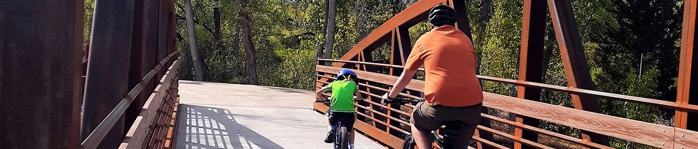
The Bear Creek Trail is located within the Bear Creek Greenbelt, a 350-acre open space park on the south side of the city. Bear Creek runs through the property and is a mature riparian ecosystem that attracts wildlife and provides an ideal outdoor recreation and open space area. The trail is approximately seven miles in length beginning near C-470 and Morrison Road and extending east to Wadsworth Boulevard and Denver.
An extremely popular regional trail connection and a green way across the city, the trail receives a lot of use. Trail use data shows over 450,000 people use this trail and open space area each year for walking, hiking, biking, fishing and other forms of non-motorized transportation and recreational uses. The attraction of a diverse range of user groups has led to increasing conflicts in recent years, which the city has been working to address.
Watch a timelapse video of one of three pedestrian bridge installations to improve the Bear Creek Trail for all users. The new multi-use trail, soft-surface parallel trail, and bridge replacements were completed in 2023 with new restroom facilities added in 2025. This bridge weighs 43,000 pounds!
Project Details
Specifically, the Bear Creek Trail project entails the installation of over 12,000 linear feet of 3-6 foot wide soft surface trail that would roughly parallel the existing concrete path through the Bear Creek Greenbelt. The purpose of this trail would be to help alleviate congestion along the existing trail by providing an alternative natural surface trail for walkers and runners. In addition to the soft surface trail construction, sections of the existing trail would be removed and replaced. Improvements would be made to the concrete trail by widening sections to 10 feet when feasible, by softening trail curves to extend sight lines and replacing damaged concrete to mitigate hazards. Engineering studies were conducted in 2020 to consider how to appropriately address high-conflict areas to devise alternative solutions. Learn more in the Bear Creek Trail section beginning on page 26 of the City of Lakewood Trail and Connectivity Assessment Report.
All proposed trail improvements have been included to create a welcoming trail experience for all visitors and user groups. Use the tools below to provide feedback on the project and share additional ideas for future amenities as funding allows. Subscribe to this page for project notifications when new information is available.
Share How do you primarily use the Bear Creek Trail? on FacebookShare How do you primarily use the Bear Creek Trail? on TwitterShare How do you primarily use the Bear Creek Trail? on LinkedinEmail How do you primarily use the Bear Creek Trail? link
Life Cycle
2016 - Development of the City of Lakewood Trails Connectivity and Assessment Report
Bear Creek Trail Improvements has finished this stage
A six month public engagement effort allowed staff to collect data and public comment resulting in recommendations and a conceptual plans for the Bear Creek Trail project.
October 2019 - Project kickoff
Bear Creek Trail Improvements has finished this stage
City Council allocated TABOR funds towards the Bear Creek Trail Improvements project in October of 2019.
November 2019- City staff applied for grant funding to support the project.
Bear Creek Trail Improvements has finished this stage
The city is seeking to partner on this project with Colorado Parks and Wildlife, the National Park Service and Jefferson County Open Space.
February 2020 -Second public engagement period begins
Bear Creek Trail Improvements has finished this stage
Following the 2016 public engagement effort, the project team has collected data and public comment for several years to refine the proposed site plan. Staff is seeking general feedback through May of 2020.
Spring 2021 - Final site plan available
Bear Creek Trail Improvements has finished this stage
The final site plan for the project will be available for public review in the spring of 2021 following completion of flood and environmental review. Survey work has begun and activity will be noted to users of the trail.
2022-2023 - Construction
Bear Creek Trail Improvements has finished this stage
The final phase of construction is underway with anticipated completion of the Bear Creek Trail improvements by mid-September! Wayfinding and upgraded sign design are now underway. Subscribe to this page for updates, closure and detour information.
September 27, 2023 -Bear Creek Trail opens!
Bear Creek Trail Improvements is currently at this stage
The full trail experience is now open! Happy trails!


 Phase3 Detour-18x24.pdf (2.09 MB) (pdf)
 City of Lakewood Trails Inventory and Connectivity Assessment Report (40.4 MB) (pdf)