West Mississippi Avenue Pilot Traffic Calming Project

Share West Mississippi Avenue Pilot Traffic Calming Project on Facebook Share West Mississippi Avenue Pilot Traffic Calming Project on X (formerly Twitter) Share West Mississippi Avenue Pilot Traffic Calming Project on Linkedin Email West Mississippi Avenue Pilot Traffic Calming Project link
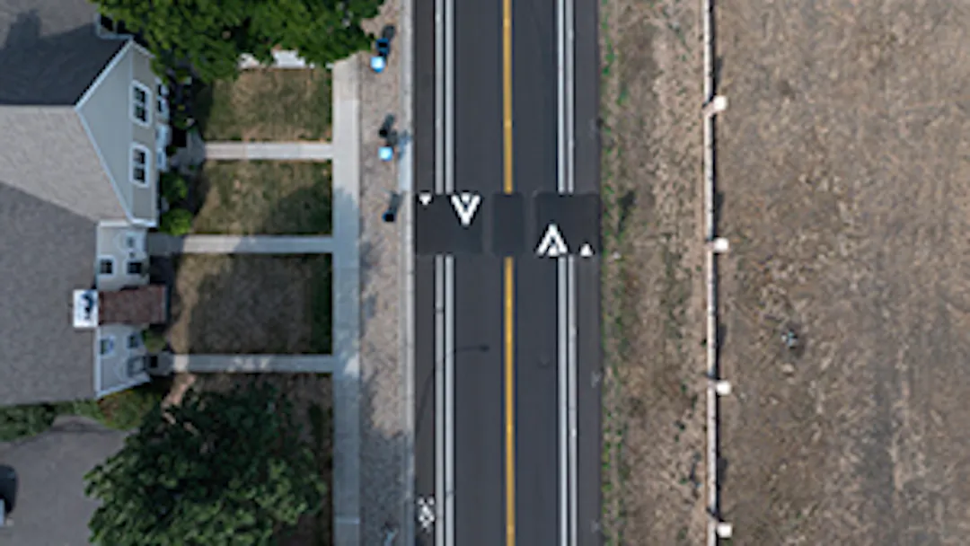
Aerial view of a speed cushion

Lakewood is launching a pilot project to evaluate ways to address speeding along the streets with higher traffic volumes in neighborhoods, and the first section of roadway to be evaluated is West Mississippi Avenue from Pierce Street to Sheridan Boulevard. The city is installing semi-permanent safety items to test their effectiveness, and we need your feedback.

Please participate in this project in the following ways:


About this project

This segment from Pierce to Sheridan has been chosen because it has a higher number of crashes than similar roadways (see crash information). It’s also a segment where people are walking or cycling, making it important to prevent serious crashes involving these nonmotorized users of the transportation system. This segment has also received a number of complaints from residents about speeding.

The pilot project involves installing speed cushions, median islands and pedestrian and bicycling crossings in various sections between Pierce and Sheridan. The speed cushions will include wheel slots to allow West Metro Fire vehicles to travel through without having to slow down significantly, resulting in minimal impact to the fire response. West Metro Fire has reviewed and approved the design for this pilot project. The tire slots, however, don’t work for standard vehicles, and drivers will have to slow to travel over the speed cushions.

Once these items are fully installed, the city will evaluate their effectiveness based on changes in driver behavior, feedback and analysis of any crashes. The results of this analysis will be posted here on the project’s webpage when they are available.

Lakewood is launching a pilot project to evaluate ways to address speeding along the streets with higher traffic volumes in neighborhoods, and the first section of roadway to be evaluated is West Mississippi Avenue from Pierce Street to Sheridan Boulevard. The city is installing semi-permanent safety items to test their effectiveness, and we need your feedback.

Please participate in this project in the following ways:


About this project

This segment from Pierce to Sheridan has been chosen because it has a higher number of crashes than similar roadways (see crash information). It’s also a segment where people are walking or cycling, making it important to prevent serious crashes involving these nonmotorized users of the transportation system. This segment has also received a number of complaints from residents about speeding.

The pilot project involves installing speed cushions, median islands and pedestrian and bicycling crossings in various sections between Pierce and Sheridan. The speed cushions will include wheel slots to allow West Metro Fire vehicles to travel through without having to slow down significantly, resulting in minimal impact to the fire response. West Metro Fire has reviewed and approved the design for this pilot project. The tire slots, however, don’t work for standard vehicles, and drivers will have to slow to travel over the speed cushions.

Once these items are fully installed, the city will evaluate their effectiveness based on changes in driver behavior, feedback and analysis of any crashes. The results of this analysis will be posted here on the project’s webpage when they are available.

  • Traffic calming measures

    Share Traffic calming measures on Facebook Share Traffic calming measures on X (formerly Twitter) Share Traffic calming measures on Linkedin Email Traffic calming measures link

    These strategies are designed to slow down drivers and reduce their speeds.

    • Narrowed Travel Lanes

      West Mississippi Avenue received a new asphalt surface this year. This allowed the city to install new striping that makes the travel lanes 11-feet in width.


    • Speed Cushions A line of speed cushions on a street.

      Speed cushions are similar in shape and size to speed humps, but they include small gaps called “cutouts” that allow wider‑tracked vehicles, such as emergency vehicles, some trucks, and some buses, to pass through without being affected. Passenger vehicles, however, must still travel over the raised portion. Like a traditional speed hump, speed cushions are designed to be comfortable to drive over at around 20–25 mph. They are often preferred on primary emergency response routes or transit routes where a traditional speed hump may not be feasible.
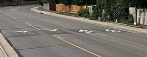
      Six speed cushions will be installed between Pierce and Sheridan. The speed cushions will include wheel slots to allow West Metro Fire vehicles to travel through this segment without having to slow down significantly, resulting in minimal impact to the fire response. West Metro Fire has reviewed and approved the design for this pilot project.
    • Median IslandsA line of yellow posts that create a median island.

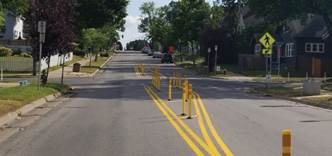
      Four median islands will be installed along the street’s centerline that visually narrow the roadway. Using vertical posts to delineate the island, the visual appearance of the lane narrows to encourage motorists to slow down. Vehicles will still be able to turn left at intersections.

    • Pedestrian and Bicycle Crossings

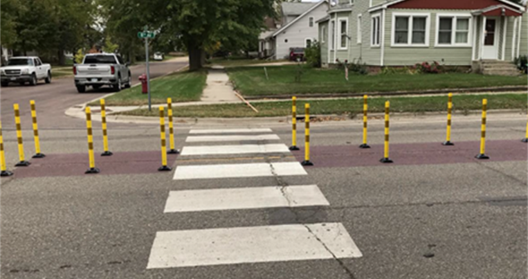
      A pedestrian and bicycle crossing protected by a median island.Two crossings, one at Marshall and one at Depew streets, will be installed to create greater safety for cyclists and pedestrians crossing West Mississippi by using median islands to provide a pedestrian refuge in the middle of the street.

    These strategies are designed to slow down drivers and reduce their speeds.

    • Narrowed Travel Lanes

      West Mississippi Avenue received a new asphalt surface this year. This allowed the city to install new striping that makes the travel lanes 11-feet in width.


    • Speed Cushions A line of speed cushions on a street.

      Speed cushions are similar in shape and size to speed humps, but they include small gaps called “cutouts” that allow wider‑tracked vehicles, such as emergency vehicles, some trucks, and some buses, to pass through without being affected. Passenger vehicles, however, must still travel over the raised portion. Like a traditional speed hump, speed cushions are designed to be comfortable to drive over at around 20–25 mph. They are often preferred on primary emergency response routes or transit routes where a traditional speed hump may not be feasible.

      Six speed cushions will be installed between Pierce and Sheridan. The speed cushions will include wheel slots to allow West Metro Fire vehicles to travel through this segment without having to slow down significantly, resulting in minimal impact to the fire response. West Metro Fire has reviewed and approved the design for this pilot project.
    • Median IslandsA line of yellow posts that create a median island.

      Four median islands will be installed along the street’s centerline that visually narrow the roadway. Using vertical posts to delineate the island, the visual appearance of the lane narrows to encourage motorists to slow down. Vehicles will still be able to turn left at intersections.


    • Pedestrian and Bicycle Crossings

      A pedestrian and bicycle crossing protected by a median island.Two crossings, one at Marshall and one at Depew streets, will be installed to create greater safety for cyclists and pedestrians crossing West Mississippi by using median islands to provide a pedestrian refuge in the middle of the street.
  • Traffic counts and crash information

    Share Traffic counts and crash information on Facebook Share Traffic counts and crash information on X (formerly Twitter) Share Traffic counts and crash information on Linkedin Email Traffic counts and crash information link

    Traffic count

    Before installing these items, the city collected and documented the current traffic volumes and average speeds of vehicles on this stretch of roadway.

    • On a typical weekday, a total of 14,771 vehicles travel in both directions on this segment. Traffic counts were taken May 22-23, 2025, just east of Marshall Street.
    • The average speed was 33 mph, and 85 percent of the cars were going 42 mph or slower.
    • During the traffic count, there were 1,976 vehicles on May 22 that exceeded the posted speed limit of 35 mph by more than 10 mph.

    Once these items are fully installed, the city will evaluate their effectiveness based on changes in driver behavior, feedback and analysis of any crashes. The results of this analysis will also be posted here on the project’s webpage when they are available.

    Crash information

    The following data is from five years: April 1, 2021-March 31, 2026.

    • 74 total crashes occurred on this portion of Mississippi. Of these 25 crashes resulted in 34 injuries to people, and the remaining 49 were property damage (or noninjury) crashes.
    • The 74 crashes can also be classified by type, as follows: 26 broadside, 20 rear-end, 9 left turn, 6 fixed object, 5 head-on, 3 sideswipe, 2 bicycle, 1 overtaking, 1 pedestrian, and 1 other.
    • 56 crashes occurred in the daytime, while 15 were at night, and 3 at dawn/dusk.
    • 11 crashes involved alcohol or drugs with an at-fault driver.

    West Mississippi Avenue Crash Summary

    West Mississippi Avenue Crash Map
    The data system stacks the crash symbols if they are coded to the same location, so there will be fewer than 74 dots or squares. Dots represent crashes involving only property damage, and squares represent injury crash locations.

    Crash Dashboard from Denver Regional Council of Governments
    Zoom in on the map for more information on each crash in your area of concern.

    Crash data for similar streets
    This data shows this segment of Mississippi has more injury crashes than West 10th, West First, West 14th, West Florida, West Jewell and West Yale avenues between Pierce and Sheridan.

    Street

    Crashes

    14th Ave

    71

    10th Ave

    27

    First Ave

    50

    Mississippi Ave

    74

    Florida Ave

    23

    Jewell Ave

    42

    Yale Ave

    11

    Traffic count

    Before installing these items, the city collected and documented the current traffic volumes and average speeds of vehicles on this stretch of roadway.

    • On a typical weekday, a total of 14,771 vehicles travel in both directions on this segment. Traffic counts were taken May 22-23, 2025, just east of Marshall Street.
    • The average speed was 33 mph, and 85 percent of the cars were going 42 mph or slower.
    • During the traffic count, there were 1,976 vehicles on May 22 that exceeded the posted speed limit of 35 mph by more than 10 mph.

    Once these items are fully installed, the city will evaluate their effectiveness based on changes in driver behavior, feedback and analysis of any crashes. The results of this analysis will also be posted here on the project’s webpage when they are available.

    Crash information

    The following data is from five years: April 1, 2021-March 31, 2026.

    • 74 total crashes occurred on this portion of Mississippi. Of these 25 crashes resulted in 34 injuries to people, and the remaining 49 were property damage (or noninjury) crashes.
    • The 74 crashes can also be classified by type, as follows: 26 broadside, 20 rear-end, 9 left turn, 6 fixed object, 5 head-on, 3 sideswipe, 2 bicycle, 1 overtaking, 1 pedestrian, and 1 other.
    • 56 crashes occurred in the daytime, while 15 were at night, and 3 at dawn/dusk.
    • 11 crashes involved alcohol or drugs with an at-fault driver.

    West Mississippi Avenue Crash Summary

    West Mississippi Avenue Crash Map
    The data system stacks the crash symbols if they are coded to the same location, so there will be fewer than 74 dots or squares. Dots represent crashes involving only property damage, and squares represent injury crash locations.

    Crash Dashboard from Denver Regional Council of Governments
    Zoom in on the map for more information on each crash in your area of concern.

    Crash data for similar streets
    This data shows this segment of Mississippi has more injury crashes than West 10th, West First, West 14th, West Florida, West Jewell and West Yale avenues between Pierce and Sheridan.

    Street

    Crashes

    14th Ave

    71

    10th Ave

    27

    First Ave

    50

    Mississippi Ave

    74

    Florida Ave

    23

    Jewell Ave

    42

    Yale Ave

    11

  • Additional speed reduction measures

    Share Additional speed reduction measures on Facebook Share Additional speed reduction measures on X (formerly Twitter) Share Additional speed reduction measures on Linkedin Email Additional speed reduction measures link

    This project is also part of the Vision Zero Action Plan for Jefferson County, which is an effort by the county and all of the cities within it to strive toward zero deaths or serious injuries from traffic crashes.

    This pilot project also follows the city’s action to reduce the speed limit to 20 mph on residential neighborhood streets. These are the local streets that directly serve homes and encourage walking, social connections and a sense of community. This 20 mph speed limit does not apply to larger collector and arterial streets that carry more traffic such as West Mississippi Avenue. Learn more about this at LakewoodCO.gov/SafeStreets

    This project is also part of the Vision Zero Action Plan for Jefferson County, which is an effort by the county and all of the cities within it to strive toward zero deaths or serious injuries from traffic crashes.

    This pilot project also follows the city’s action to reduce the speed limit to 20 mph on residential neighborhood streets. These are the local streets that directly serve homes and encourage walking, social connections and a sense of community. This 20 mph speed limit does not apply to larger collector and arterial streets that carry more traffic such as West Mississippi Avenue. Learn more about this at LakewoodCO.gov/SafeStreets

Page published: 04 Sep 2026, 12:43 PM