Floodplain regulations update
Help us update our floodplain management regulations
We're looking to update our floodplain management ordinance, and we want to hear from you. Projects such as this are made better with your feedback, so please participate:
- Attend Sept. 17 informational open house from 5 to 7 p.m. in the lobby of the permit counter at 470 S. Allison Parkway.
- Learn more about the update to floodplain regulations and what it means you and the city.
- Review the answers to frequently asked questions.
- Review the Floodplain Hazard Map or visit the Lakewood Atlas to show the floodplains.
- Follow our timeline.
- Ask a question.
- Take our quick polls.
About this project
Lakewood’s floodplain regulations guide development and construction in areas at risk for flooding in the city, and those regulations need periodic updates based on new flood studies as well as Colorado and federal standards. Work to revise these requirements is now getting underway.
Known as Lakewood’s Floodplain Management Ordinance, these regulations protect public safety, reduce property damage, preserve natural drainage systems, and ensure the community remains eligible for important state and federal flood mitigation and insurance programs including the National Flood Insurance Program. This is important for you as a resident because Lakewood’s participation in the National Flood Insurance Program allows you to buy discounted flood insurance for your home or belongings through your insurance agent.
Lakewood has participated in the National Flood Insurance Program since 1972, and the city also participates in the Community Rating System, a voluntary program that recognizes and encourages high community standards for floodplain management by discounting flood insurance premium rates.
Your participation in this project is important because these rules for building, permitting, and land use ensure development occurs safely and without increasing flood risks for others. These updates also incorporate floodplain map revisions with the most accurate data available, and they refine language, address common resident concerns, and eliminate unnecessary requirements to improve clarity and ease of compliance.
Updating the ordinance is important because flood risk changes over time, mapping improves, and state and federal requirements evolve. Updates will strengthen community resilience, support responsible development, and help protect the safety and property of all Lakewood residents.
Help us update our floodplain management regulations
We're looking to update our floodplain management ordinance, and we want to hear from you. Projects such as this are made better with your feedback, so please participate:
- Attend Sept. 17 informational open house from 5 to 7 p.m. in the lobby of the permit counter at 470 S. Allison Parkway.
- Learn more about the update to floodplain regulations and what it means you and the city.
- Review the answers to frequently asked questions.
- Review the Floodplain Hazard Map or visit the Lakewood Atlas to show the floodplains.
- Follow our timeline.
- Ask a question.
- Take our quick polls.
About this project
Lakewood’s floodplain regulations guide development and construction in areas at risk for flooding in the city, and those regulations need periodic updates based on new flood studies as well as Colorado and federal standards. Work to revise these requirements is now getting underway.
Known as Lakewood’s Floodplain Management Ordinance, these regulations protect public safety, reduce property damage, preserve natural drainage systems, and ensure the community remains eligible for important state and federal flood mitigation and insurance programs including the National Flood Insurance Program. This is important for you as a resident because Lakewood’s participation in the National Flood Insurance Program allows you to buy discounted flood insurance for your home or belongings through your insurance agent.
Lakewood has participated in the National Flood Insurance Program since 1972, and the city also participates in the Community Rating System, a voluntary program that recognizes and encourages high community standards for floodplain management by discounting flood insurance premium rates.
Your participation in this project is important because these rules for building, permitting, and land use ensure development occurs safely and without increasing flood risks for others. These updates also incorporate floodplain map revisions with the most accurate data available, and they refine language, address common resident concerns, and eliminate unnecessary requirements to improve clarity and ease of compliance.
Updating the ordinance is important because flood risk changes over time, mapping improves, and state and federal requirements evolve. Updates will strengthen community resilience, support responsible development, and help protect the safety and property of all Lakewood residents.
Ask a question
Ask a question here and staff will respond as soon as possible, usually within three business days. Questions and responses may be posted publicly.
For general questions and concerns about the city, please visit LakewoodCO.gov/Request(External link)(External link), which is the city's online customer service hub available 24 hours a day.
-
Share I live in the Country Manor estates neighborhood bordering the Wilson Family Park. It sounds like there is a plan in place to rehome the beavers that have taken up residence next to the pond, in large part beavers do not do well being rehomed for a myriad of reasons and the surrounding areas generally adjust and thrive with their presence. I am concerned about the upset to our ecosystem as I care very much about our wildlife and feel this will be horribly destructive. Are there any measures that can be considered? Better solutions often exist through infrastructure adaption and "living with beavers”. Mitigation solutions like flow devices, culvert protectors or tree fencing can prevent blocked water from flooding things out and trees from felling. The materials are easy to source and install, and allow the beavers to stay in place – providing ecosystem benefits. Some helpful info. Please reconsider, we move here to be closer to nature, not to destroy it. https://beaverworksoregon.org/beaver-reading/why-we-dont-relocate-beavers/ on Facebook Share I live in the Country Manor estates neighborhood bordering the Wilson Family Park. It sounds like there is a plan in place to rehome the beavers that have taken up residence next to the pond, in large part beavers do not do well being rehomed for a myriad of reasons and the surrounding areas generally adjust and thrive with their presence. I am concerned about the upset to our ecosystem as I care very much about our wildlife and feel this will be horribly destructive. Are there any measures that can be considered? Better solutions often exist through infrastructure adaption and "living with beavers”. Mitigation solutions like flow devices, culvert protectors or tree fencing can prevent blocked water from flooding things out and trees from felling. The materials are easy to source and install, and allow the beavers to stay in place – providing ecosystem benefits. Some helpful info. Please reconsider, we move here to be closer to nature, not to destroy it. https://beaverworksoregon.org/beaver-reading/why-we-dont-relocate-beavers/ on X (formerly Twitter) Share I live in the Country Manor estates neighborhood bordering the Wilson Family Park. It sounds like there is a plan in place to rehome the beavers that have taken up residence next to the pond, in large part beavers do not do well being rehomed for a myriad of reasons and the surrounding areas generally adjust and thrive with their presence. I am concerned about the upset to our ecosystem as I care very much about our wildlife and feel this will be horribly destructive. Are there any measures that can be considered? Better solutions often exist through infrastructure adaption and "living with beavers”. Mitigation solutions like flow devices, culvert protectors or tree fencing can prevent blocked water from flooding things out and trees from felling. The materials are easy to source and install, and allow the beavers to stay in place – providing ecosystem benefits. Some helpful info. Please reconsider, we move here to be closer to nature, not to destroy it. https://beaverworksoregon.org/beaver-reading/why-we-dont-relocate-beavers/ on Linkedin Email I live in the Country Manor estates neighborhood bordering the Wilson Family Park. It sounds like there is a plan in place to rehome the beavers that have taken up residence next to the pond, in large part beavers do not do well being rehomed for a myriad of reasons and the surrounding areas generally adjust and thrive with their presence. I am concerned about the upset to our ecosystem as I care very much about our wildlife and feel this will be horribly destructive. Are there any measures that can be considered? Better solutions often exist through infrastructure adaption and "living with beavers”. Mitigation solutions like flow devices, culvert protectors or tree fencing can prevent blocked water from flooding things out and trees from felling. The materials are easy to source and install, and allow the beavers to stay in place – providing ecosystem benefits. Some helpful info. Please reconsider, we move here to be closer to nature, not to destroy it. https://beaverworksoregon.org/beaver-reading/why-we-dont-relocate-beavers/ link
I live in the Country Manor estates neighborhood bordering the Wilson Family Park. It sounds like there is a plan in place to rehome the beavers that have taken up residence next to the pond, in large part beavers do not do well being rehomed for a myriad of reasons and the surrounding areas generally adjust and thrive with their presence. I am concerned about the upset to our ecosystem as I care very much about our wildlife and feel this will be horribly destructive. Are there any measures that can be considered? Better solutions often exist through infrastructure adaption and "living with beavers”. Mitigation solutions like flow devices, culvert protectors or tree fencing can prevent blocked water from flooding things out and trees from felling. The materials are easy to source and install, and allow the beavers to stay in place – providing ecosystem benefits. Some helpful info. Please reconsider, we move here to be closer to nature, not to destroy it. https://beaverworksoregon.org/beaver-reading/why-we-dont-relocate-beavers/
jenni asked 12 days agoThanks for your interest in this project, and we apologize for the delay in responding to your question. Public Works staff met with Mile High Flood District last week about Sanderson Gulch, and we're working to get an update based on that meeting. We'll provide you that update as soon as it's available.
Kind regards,
The Project Team
UPDATE: The meeting with Mile High Flood District identified the beaver dam, but it isn’t adversely affecting the floodplain or posing a flood risk, so we are going to leave the beaver. This is a good of location as any for him to live.
Kind regards,
The Project Team
-
Share Is there a plan for cleaning up the Sanderson Gulch drainage/ponds in the Wilson Park area? There is a family of beavers that have been decimating the trees in the park. Not only are they killing the trees, they have built a dam on the water way which leaves standing water, increasing mosquito populations and trash collection. The step down under the Country Manor bridge is filled with branches and trash, clogging the drainage. This is in the flood plain area because it is not being properly maintained. I would appreciate any updates or communication you have. Thank you. on Facebook Share Is there a plan for cleaning up the Sanderson Gulch drainage/ponds in the Wilson Park area? There is a family of beavers that have been decimating the trees in the park. Not only are they killing the trees, they have built a dam on the water way which leaves standing water, increasing mosquito populations and trash collection. The step down under the Country Manor bridge is filled with branches and trash, clogging the drainage. This is in the flood plain area because it is not being properly maintained. I would appreciate any updates or communication you have. Thank you. on X (formerly Twitter) Share Is there a plan for cleaning up the Sanderson Gulch drainage/ponds in the Wilson Park area? There is a family of beavers that have been decimating the trees in the park. Not only are they killing the trees, they have built a dam on the water way which leaves standing water, increasing mosquito populations and trash collection. The step down under the Country Manor bridge is filled with branches and trash, clogging the drainage. This is in the flood plain area because it is not being properly maintained. I would appreciate any updates or communication you have. Thank you. on Linkedin Email Is there a plan for cleaning up the Sanderson Gulch drainage/ponds in the Wilson Park area? There is a family of beavers that have been decimating the trees in the park. Not only are they killing the trees, they have built a dam on the water way which leaves standing water, increasing mosquito populations and trash collection. The step down under the Country Manor bridge is filled with branches and trash, clogging the drainage. This is in the flood plain area because it is not being properly maintained. I would appreciate any updates or communication you have. Thank you. link
Is there a plan for cleaning up the Sanderson Gulch drainage/ponds in the Wilson Park area? There is a family of beavers that have been decimating the trees in the park. Not only are they killing the trees, they have built a dam on the water way which leaves standing water, increasing mosquito populations and trash collection. The step down under the Country Manor bridge is filled with branches and trash, clogging the drainage. This is in the flood plain area because it is not being properly maintained. I would appreciate any updates or communication you have. Thank you.
Stacy asked 29 days agoThanks for contacting us about this issue. While this project to update the floodplain regulations addresses future development and construction, the city's staff will be meeting with Mile High Flood District on-site in the gulch within the next two weeks to discuss maintenance operations to address the noted issues. For requests and concerns such as this, please use Request Lakewood, our customer service hub that routes these kinds of concerns directly to appropriate staff and provides you a response.
Kind regards,
The Project Team
-
Share I am hoping that Lakewood leave the Sanderson Gulch beaver population alone. They have been very helpful in promoting water quality and reducing pond smells this summer. There are other options for Lakewood managers to manage this group other than moving this population. The Wilson Family park is a barren field, and I believe trees should be planted here to compensate for trees beavers are cutting down. This park has potential, and beavers need to be seen for their benefits here. on Facebook Share I am hoping that Lakewood leave the Sanderson Gulch beaver population alone. They have been very helpful in promoting water quality and reducing pond smells this summer. There are other options for Lakewood managers to manage this group other than moving this population. The Wilson Family park is a barren field, and I believe trees should be planted here to compensate for trees beavers are cutting down. This park has potential, and beavers need to be seen for their benefits here. on X (formerly Twitter) Share I am hoping that Lakewood leave the Sanderson Gulch beaver population alone. They have been very helpful in promoting water quality and reducing pond smells this summer. There are other options for Lakewood managers to manage this group other than moving this population. The Wilson Family park is a barren field, and I believe trees should be planted here to compensate for trees beavers are cutting down. This park has potential, and beavers need to be seen for their benefits here. on Linkedin Email I am hoping that Lakewood leave the Sanderson Gulch beaver population alone. They have been very helpful in promoting water quality and reducing pond smells this summer. There are other options for Lakewood managers to manage this group other than moving this population. The Wilson Family park is a barren field, and I believe trees should be planted here to compensate for trees beavers are cutting down. This park has potential, and beavers need to be seen for their benefits here. link
I am hoping that Lakewood leave the Sanderson Gulch beaver population alone. They have been very helpful in promoting water quality and reducing pond smells this summer. There are other options for Lakewood managers to manage this group other than moving this population. The Wilson Family park is a barren field, and I believe trees should be planted here to compensate for trees beavers are cutting down. This park has potential, and beavers need to be seen for their benefits here.
mpruett asked 12 days agoThanks for your interest in this project, and we apologize for the delay in responding to your question. Public Works staff met with Mile High Flood District last week about Sanderson Gulch, and we're working to get an update based on that meeting. We'll provide you that update as soon as it's available.
Kind regards,
The Project Team
UPDATE: The meeting with Mile High Flood District identified the beaver dam, but it isn’t adversely affecting the floodplain or posing a flood risk, so we are going to leave the beaver. This is a good of location as any for him to live.
Kind regards,
The Project Team
-
Share Where can I view the floodplain map? on Facebook Share Where can I view the floodplain map? on X (formerly Twitter) Share Where can I view the floodplain map? on Linkedin Email Where can I view the floodplain map? link
Where can I view the floodplain map?
Doug asked about 1 month agoUpdated answer: Please visit the Floodplain Hazard Map that is now on the project page. You can also visit the Lakewood Atlas, where you can turn on the layers for floodplains on the left side of the map, shown by the symbol of stacks of paper. You can then type in your address to see your property in relation to the floodplain. For the legend of the symbols shown on the Lakewood Atlas map, click on the item that looks like a list of bulleted points. To understand how to use the Lakewood Atlas digital map, click on the question mark.
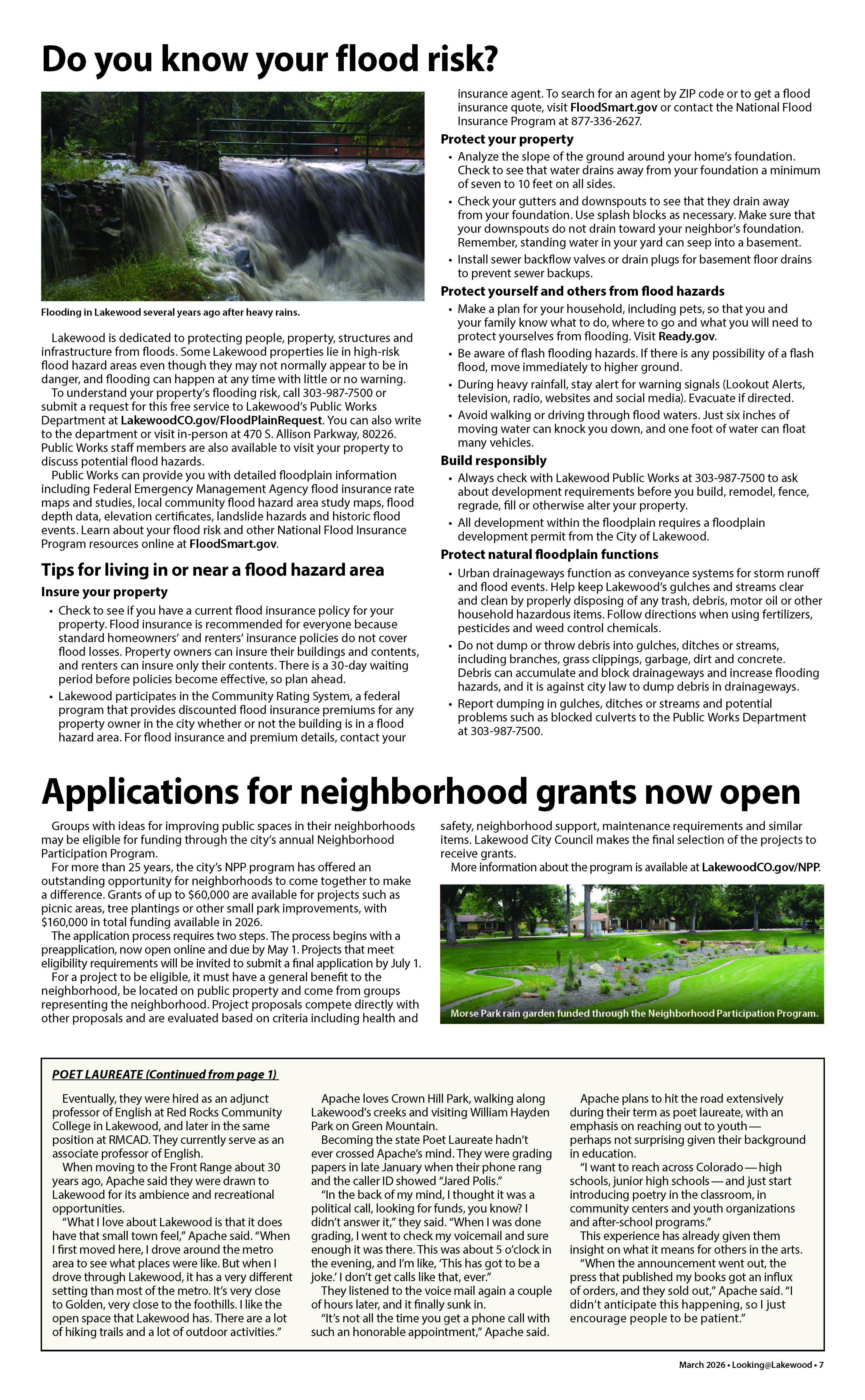
I'm checking on whether there is a map that can be posted on this project page. In the meantime, please see the attached image of the article about flooding issues that we run once a year in Looking@Lakewood, the city's printed newsletter mailed to all addresses in the city. It talks about the city's free service that staff will provide in determining the flooding status of your property. You make that request at LakewoodCO.gov/FloodPlainRequest(External link). If you prefer, you can read the article at this link: www.lakewoodco.gov/files/assets/public/v/1/city-managers-office/communications/ll-pdfs/looking-at-lakewood-march-2026_digital-acc.pdf.
Sincerely,
Stacie Oulton
Public Information Manager -
Share I am sure I am missing something obvious, but I don’t see a map to see if our house is now (or maybe always has been!) in an elevated flood risk area that may require flood insurance. Is there such a map I can look at? Or an address checker or some such? Thanks so much! on Facebook Share I am sure I am missing something obvious, but I don’t see a map to see if our house is now (or maybe always has been!) in an elevated flood risk area that may require flood insurance. Is there such a map I can look at? Or an address checker or some such? Thanks so much! on X (formerly Twitter) Share I am sure I am missing something obvious, but I don’t see a map to see if our house is now (or maybe always has been!) in an elevated flood risk area that may require flood insurance. Is there such a map I can look at? Or an address checker or some such? Thanks so much! on Linkedin Email I am sure I am missing something obvious, but I don’t see a map to see if our house is now (or maybe always has been!) in an elevated flood risk area that may require flood insurance. Is there such a map I can look at? Or an address checker or some such? Thanks so much! link
I am sure I am missing something obvious, but I don’t see a map to see if our house is now (or maybe always has been!) in an elevated flood risk area that may require flood insurance. Is there such a map I can look at? Or an address checker or some such? Thanks so much!
Mike N asked about 2 months agoUpdated answer: Please visit the Floodplain Hazard Map that is now on the project page. You can also visit the Lakewood Atlas, where you can turn on the layers for floodplains on the left side of the map, shown by the symbol of stacks of paper. You can then type in your address to see your property in relation to the floodplain. For the legend of the symbols shown on the Lakewood Atlas map, click on the item that looks like a list of bulleted points. To understand how to use the Lakewood Atlas digital map, click on the question mark.
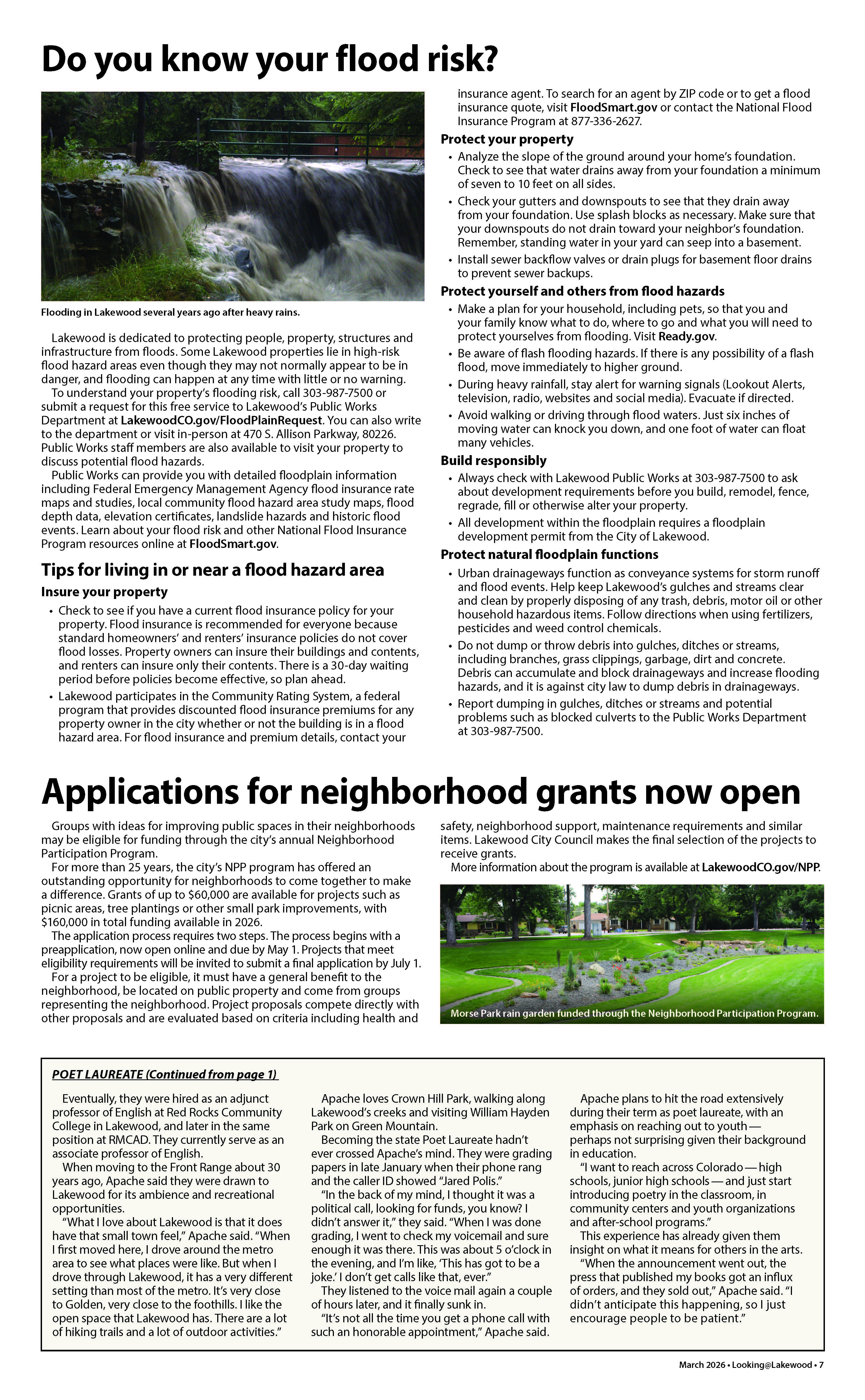
Thanks for your interest in this project. I'm checking on whether there is a map that can be posted. In the meantime, please see the attached image of the article about flooding issues that we run once a year in Looking@Lakewood, the city's printed newsletter mailed to all addresses in the city. It talks about the city's free service that staff will provide in determining the flooding status of your property. You make that request at LakewoodCO.gov/FloodPlainRequest(External link). If you prefer, you can read the article at this link: www.lakewoodco.gov/files/assets/public/v/1/city-managers-office/communications/ll-pdfs/looking-at-lakewood-march-2026_digital-acc.pdf.
-
Share Why isn't a city map of flood areas shown as the beginning of this? on Facebook Share Why isn't a city map of flood areas shown as the beginning of this? on X (formerly Twitter) Share Why isn't a city map of flood areas shown as the beginning of this? on Linkedin Email Why isn't a city map of flood areas shown as the beginning of this? link
Why isn't a city map of flood areas shown as the beginning of this?
sewing57 asked about 2 months agoUpdated answer: Please visit the Floodplain Hazard Map that is now on the project page. You can also visit the Lakewood Atlas, where you can turn on the layers for floodplains on the left side of the map, shown by the symbol of stacks of paper. You can then type in your address to see your property in relation to the floodplain. For the legend of the symbols shown on the Lakewood Atlas map, click on the item that looks like a list of bulleted points. To understand how to use the Lakewood Atlas digital map, click on the question mark.
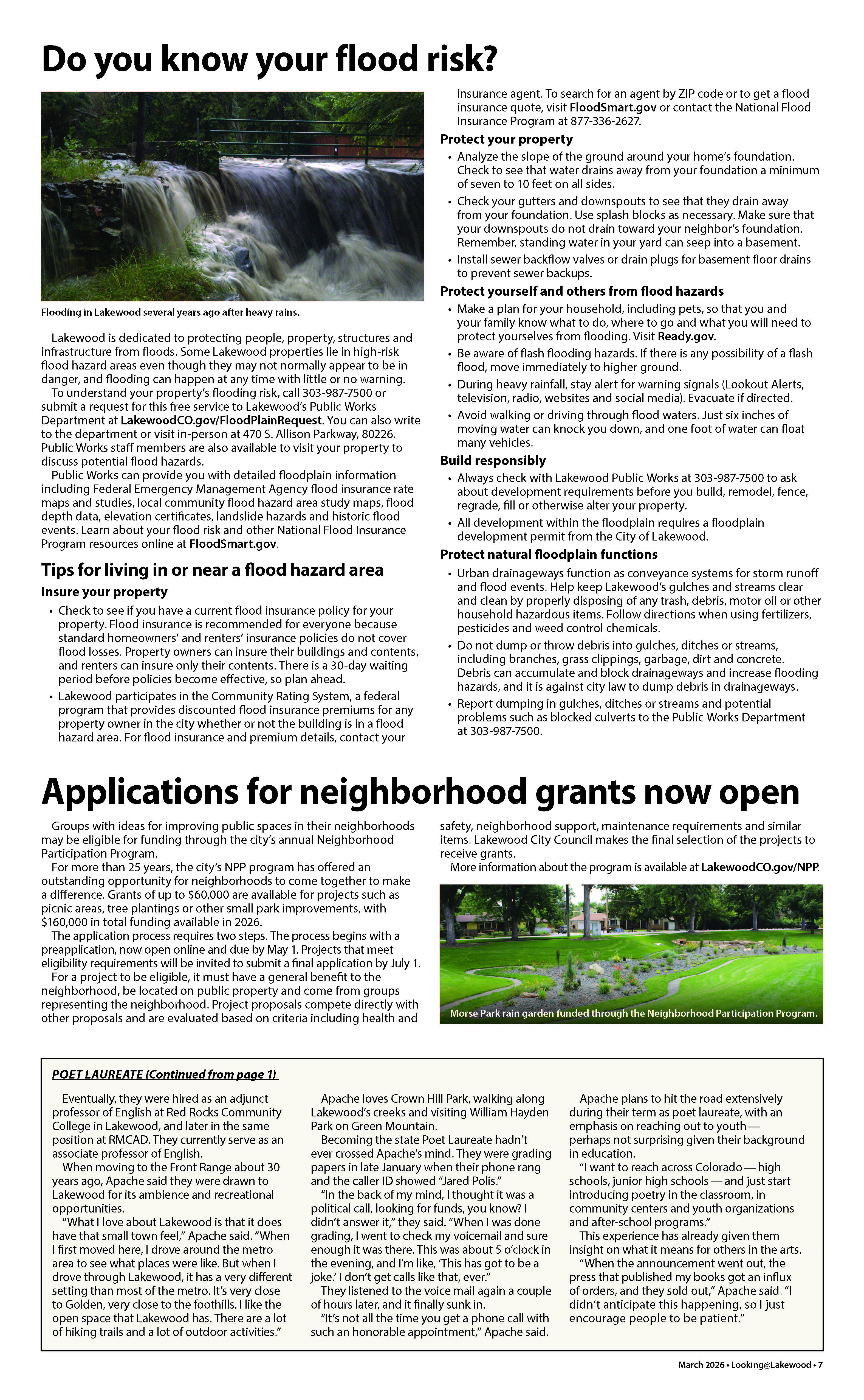
Thanks for your interest in this question, which is a good one. I'm checking on whether there is a map that can be posted, but in the meantime, please see the attached image of the article about flooding issues that we run once a year in Looking@Lakewood, the city's printed newsletter mailed to all addresses in the city. It talks about the city's free service that staff will provide in determining the flooding status of your property. You make that request at LakewoodCO.gov/FloodPlainRequest. If you prefer, you can read the article at this link: www.lakewoodco.gov/files/assets/public/v/1/city-managers-office/communications/ll-pdfs/looking-at-lakewood-march-2026_digital-acc.pdf.
Sincerely,
Stacie Oulton
Public Information Manager
Visit the Lakewood Atlas(External link) to turn on the layers for floodplains on the left side of the map, shown by the symbol of stacks of paper. You can then type in your address without using punctuation in the address to see your property in relation to the floodplain. For the legend of the symbols shown on the Lakewood Atlas map, click on the item that looks like a list of bulleted points. To understand how to use the Lakewood Atlas digital map, click on the question mark.
-
August 2026
Floodplain regulations update has finished this stageDigital engagement page launches for residents' participation.
-
Sept. 17, 2026
Floodplain regulations update is currently at this stageInformational open house from 5 to 7 p.m. at the Public Works permit counter lobby, 470 S. Allison Parkway.
-
Oct. 22, 2026
this is an upcoming stage for Floodplain regulations updateInformational open house.
-
Nov. 19, 2026
this is an upcoming stage for Floodplain regulations updateInformational open house.
-
Date TBD
this is an upcoming stage for Floodplain regulations updateCity Council to set the date for the public hearing on proposed ordinance.
-
Date TBD
this is an upcoming stage for Floodplain regulations updateCity Council public hearing.
If you need an accessible version of any documents on this project page, please contact adacoordinator@lakewood.org(External link)(External link).
Thank you for your contribution!
Help us reach out to more people in the community
Share this with family and friends