
Colorado Wildfire Resiliency Code Map
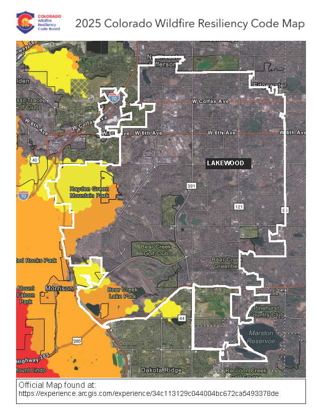
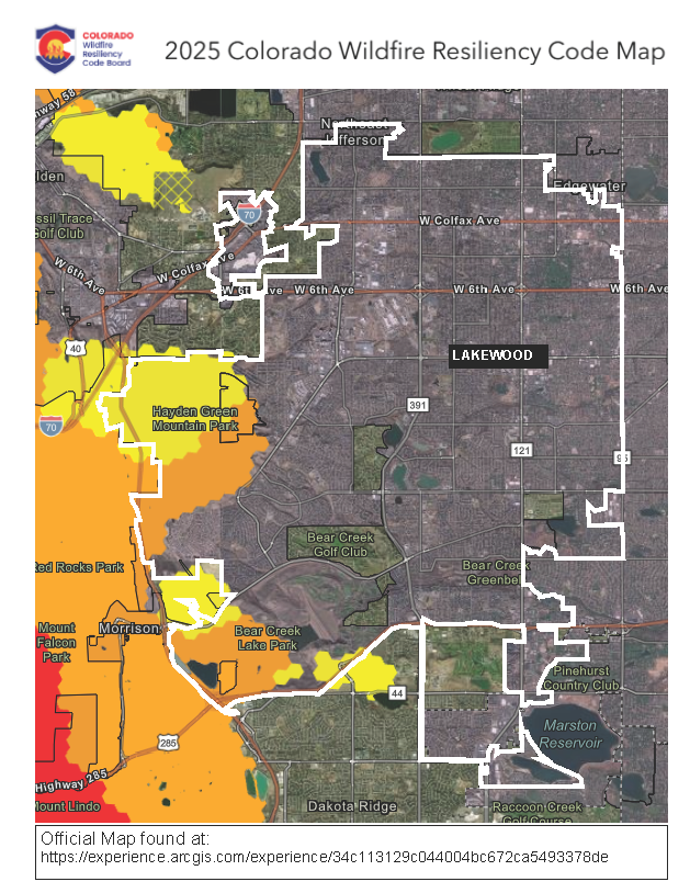
The Wildfire Resiliency Code (WRC) will apply to the areas shown in yellow, orange, or red on the map below, which includes fewer than 500 properties in Lakewood.
This map was developed by the Division of Fire Prevention and Control (DFPC) and the Colorado State Forest Service (CSFS) to show the potential Wildland Urban Interface (WUI), which is defined as the geographic areas where human development and wildland vegetation meet, creating higher exposure to embers, radiant heat, and direct flames. It shows the Fire Intensity Classification based on the 2022 Colorado Wildfire Risk Assessment, and includes data about vegetation, topography, and weather conditions such as wind to give an indication of how intense a wildfire may be if one occurs.
- Fire Intensity Classification:
- Yellow - Low Intensity (corresponds to Class 1 standards in the WRC)
- Orange - Moderate Intensity (corresponds to Class 2 standards in the WRC)
- Red - High Intensity, none in Lakewood (corresponds to Class 2 standards in the WRC)
Use the State's GIS map to explore specific locations within Lakewood and across the state: 2025 Colorado Wildfire Resiliency Code Map

Thank you for your contribution!
Help us reach out to more people in the community
Share this with family and friends